This dataset contains data to generate example prioritizations for the pale-headed Rosella (Platycercus adscitus) in Queensland, Australia.
Format
"cs_pus.gpkg"Geopackage file
"cs_species.tif"GeoTIFF file.
"cs_space.tif"GeoTIFF file.
Details
The objects in the dataset are listed below.
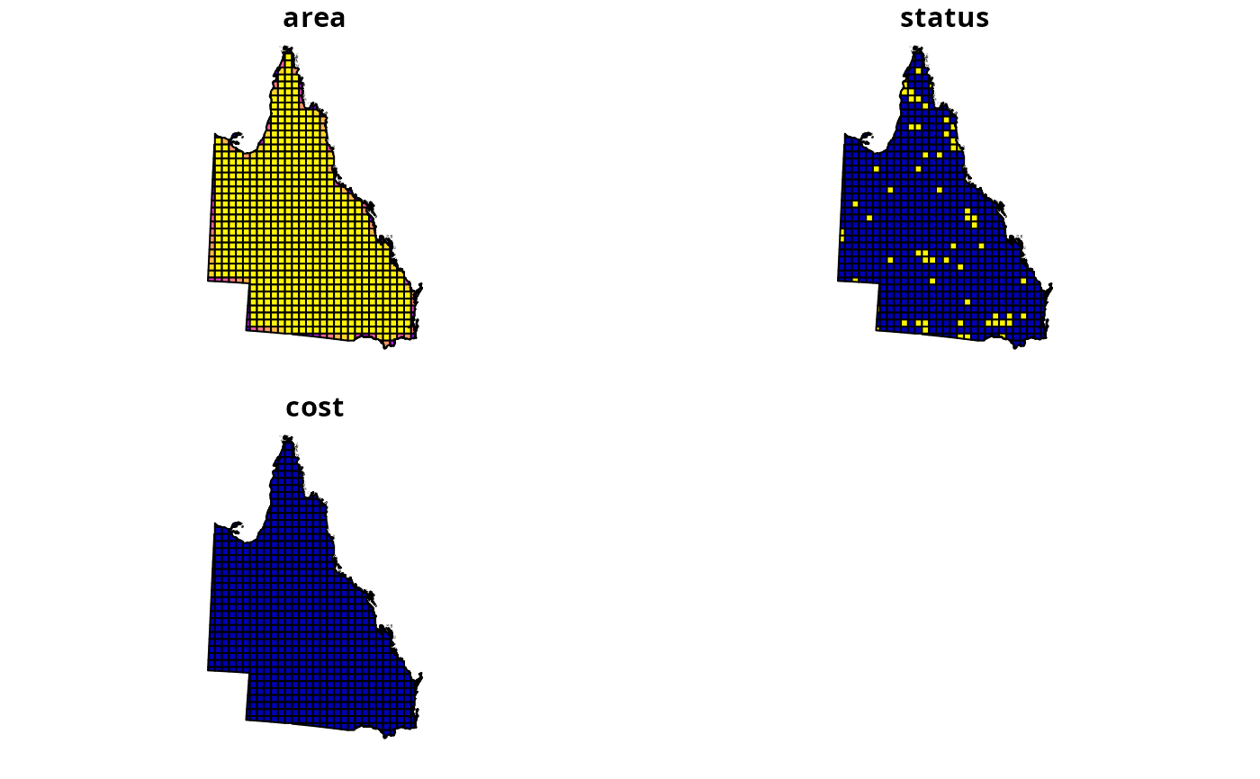
"cs_pus.gpkg"Geopackage file containing planning units. The units were generated as \(30km^2\) squares across the species' range, and then clipped to the Queensland, Australia (using data obtained from the Australia Bureau of Statistics; https://www.abs.gov.au/ausstats/[email protected]/mf/1259.0.30.001?OpenDocument). They were then overlaid with Australia's protected area network (obtained from the World Database on Protected Areas (WDPA) at https://www.protectedplanet.net/en). This attribute table has 3 fields. The
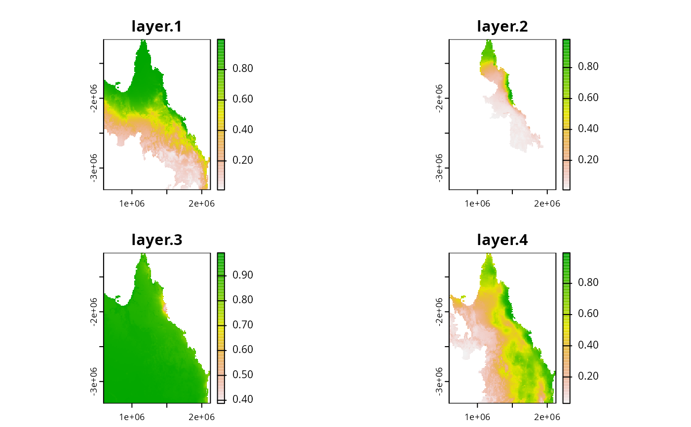
areafield denotes the amount of land encompassed by each unit, thecostfield is set to 1 for all units, and thestatusfield indicates if 50% or more of the units' extent is covered by protected areas."cs_spp.tif"GeoTIFF file containing probability distribution map for the P. adscitus clipped to Queensland, Australia. This map was derived from records obtained from The Atlas of Living Australia.
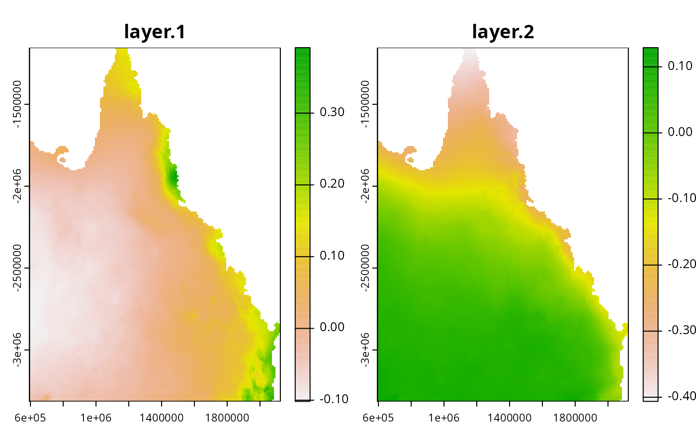
"cs_space.tif"GeoTIFF file describing broad-scale climate variation across Queensland (obtained from https://worldclim.org/, and resampled to \(10km^2\) resolution).
Examples
# \dontrun{
# load data
cs_pus <- sf::read_sf(
 system.file("extdata", "cs_pus.gpkg", package = "raptr")
)
cs_spp <- terra::rast(
  system.file("extdata", "cs_spp.tif", package = "raptr")
)
cs_space <- terra::rast(
  system.file("extdata", "cs_space.tif", package = "raptr")
)

# plot data
plot(cs_pus)

plot(cs_spp)

plot(cs_space)

# }
# }